Canyoning in Nepal
US $159

Everest and Annapurna get you mountains. The Mundhum Trail gets you mountains, and something most treks in Nepal simply don’t have: a route built around the living culture of the Kirat people, one of Nepal’s oldest ethnic groups. Instead of climbing a valley toward a single destination, you’ll spend most of this trek walking long, open ridgelines through Rai villages in eastern Nepal, with wide views the whole way rather than a river hemming you in on both sides. The trek climaxes at Silichung Peak (4,153m), a ridge-top viewpoint where, on a clear day, Everest, Kanchenjunga, Lhotse, and Makalu are all visible at once.
This route only opened to trekkers in 2018, when Nepal’s government named it one of the country’s 100 must-visit destinations — genuinely recent by Nepal trekking standards, and part of why it still sees a fraction of the traffic that Everest and Annapurna do. You can also reach the trailhead entirely by road, so there’s no domestic mountain flight required just to start walking.
The Mundhum Trail and Kirat Heritage Mundhum is the spiritual, cultural, and oral tradition of the Kirat people, encompassing their beliefs, rituals, stories, and understanding of the world. The trail takes its name directly from this tradition, and walking it means passing through villages where Mundhum still shapes daily and spiritual life, not a historical curiosity presented for visitors.
Ridge Walking Most of Nepal’s classic treks follow a river valley, climbing steadily alongside the water toward a single destination. The Mundhum Trail does something different: for long stretches, you’re walking along open ridgelines, with views out over valleys on both sides rather than up at canyon walls. It’s a genuinely different rhythm and feel from a valley trek, and it’s a big part of what makes this route distinctive.
Silichung Peak The trek’s high point and its centerpiece. An early-morning climb, demanding but non-technical, brings you to 4,153m, where a wide Himalayan panorama opens up — Everest, Kanchenjunga, Lhotse, and Makalu are the peaks most consistently reported, From the summit, clear-weather views can include Everest, Kanchenjunga, Lhotse, and Makalu, creating one of the most impressive multi-peak panoramas of the eastern Himalayas. Worth confirming which figure to use consistently before publishing. Either way, it’s a genuinely rare vantage point — very few places in Nepal let you see this many of the world’s highest mountains from one spot.
Salpa Bhanjyang and Salpa Pokhari Before the push to Silichung, the trail passes through Salpa Bhanjyang and the sacred lake of Salpa Pokhari, sitting at roughly 3,672m. This is one of the most spiritually significant stops on the entire route, drawing Hindu and Kirati pilgrims annually, especially around the full moon.
Forests and Rural Landscapes The trail shifts through rhododendron, pine, oak, and bamboo forest as you climb, with open grazing pasture and terraced farmland breaking up the tree cover in the lower and middle sections. It’s a genuinely varied walk, not just one type of forest the whole way through.
This is likely the single biggest thing a generic write-up of this trek would miss, so it’s worth covering properly rather than in passing. The Kirat are considered one of Nepal’s oldest ethnic groups, and the Rai communities you’ll walk through along this route are part of that broader Kirati heritage. Villages here are built around farming and livestock, much as they have been for generations, and Mundhum — the Kirat spiritual tradition — remains a genuine part of daily and ceremonial life, not something performed for trekkers passing through. You’ll encounter traditional religious sites, prayer structures, local architecture, and cultural practices reflecting the region’s Kirati heritage and its long interaction with neighboring Himalayan traditions.. Traditional architecture, local farming methods, and everyday village routines are all part of what you’ll actually see and experience here — real, ongoing rural life, not a preserved display of it.
At 4,153m, Silichung (also known locally as Salpa Peak) is both the highest point of the trek and its main destination. You’ll leave Salpa Bhanjyang early in the morning for the climb — demanding, given the altitude and the sustained ascent, but not technical; no climbing equipment is needed. From the summit, the reward is a wide Himalayan panorama: Everest, Kanchenjunga, Lhotse, and Makalu are the peaks most reliably reported, with Cho Oyu occasionally visible as well on especially clear days. After taking it in, you’ll descend back to Salpa Bhanjyang for the night.
Salpa Pokhari is a sacred lake sitting at roughly 3,672m, close to Salpa Bhanjyang and just below Silichung Peak. It’s considered holy by both Hindu and Kirati traditions, and pilgrims visit every year, particularly around the full moon. Camping or staying overnight near its still water is one of the more memorable stops on the whole route, and its position right before the push to Silichung makes it a natural, meaningful staging point for the trek’s biggest day.
This trek is a good fit for:
The trek is rated moderate, and that’s a fair rating — but it’s worth setting real expectations. Trekking days generally run 4-7 hours, with several consecutive days of continuous uphill and downhill walking on undulating ridge trail. Basic fitness is enough to complete it, but “basic fitness” still means being comfortable with sustained daily walking, not an easy stroll.
| Mundhum Trail | Everest / Annapurna | |
|---|---|---|
| Region | Eastern Nepal | More established trekking regions |
| Culture | Kirat-focused | Sherpa, Gurung, and other Himalayan cultures |
| Route style | Ridge walking | Valley and mountain-focused routes |
| Crowds | Fewer trekkers | Generally busier |
| Signature destination | Silichung viewpoint | Base camps or high passes |
| Infrastructure | More basic, remote | Better-developed trekking infrastructure |
This isn’t about one being “better” than the other — they’re genuinely different kinds of trips. If you want the classic base-camp or high-pass experience with well-established infrastructure, Everest or Annapurna deliver that brilliantly. If you want a quieter, culture-first ridge trek in a part of Nepal most trekkers never see, Mundhum is built for that instead.
Daily walking runs roughly 4-7 hours, over undulating ridge trail with several days of continuous uphill and downhill sections. No technical climbing is involved anywhere on the route.
Altitude. The trek’s highest point, Silichung Peak, sits at 4,153m — high enough to feel the altitude on the final push, but well below the range where serious altitude sickness becomes a major concern.
Accommodation. Expect a mix of basic teahouses, simple lodges, and camping, particularly around Salpa Bhanjyang and Silichung, where infrastructure is more limited than on Nepal’s busier routes.
Best time to go. Spring (March-May) and autumn (September-November) offer the clearest skies for the Silichung panorama.
Day 1: Drive from Kathmandu to Diktel (1,650m)
Day 2: Drive from Diktel to Chakhewa Bhanjyang, short trek
Day 3: Trek to Dhotre (2,752m)
Day 4: Trek to Maiyung/Hans Pokhari (3,122m)
Day 5: Trek to Rawa Dhap (3,426m)
Day 6: Trek to Salpa Bhanjyang (3,350m)
Day 7: Hike to Silichung Peak (4,153m), return to Salpa
Day 8: Trek to Gudel or the lower region Day 9: Trek to the road point
Day 10: Drive to Tumlingtar or Bhojpur
Day 11: Return to Kathmandu, by flight or drive
Day 1: Drive from Kathmandu to Diktel (1,650m)
A long road journey east out of the Kathmandu Valley into Khotang district, ending in Diktel, the district headquarters and your gateway to the trek.
Day 2: Drive from Diktel to Chakhewa Bhanjyang, short trek
A further drive to Chakhewa Bhanjyang (around 2,300m), the official starting point of the Mundhum Trail, followed by a short first walk to ease into the route.
Day 3: Trek to Dhotre (2,752m)
The trail begins climbing in earnest, passing through forest and small Rai settlements as the ridge walking properly begins.
Day 4: Trek to Maiyung/Hans Pokhari (3,122m)
A shorter, easier day through scenic terrain, arriving at Maiyung — also known as Hans Pokhari — a traditional yak and horse pastureland with a genuinely peaceful feel.
Day 5: Trek to Rawa Dhap (3,426m)
Passing through spots like Hyakule along the way, the trail reaches Rawa Dhap, the source of the Rawa and Tap rivers, with good mountain views opening up as you climb.
Day 6: Trek to Salpa Bhanjyang (3,350m)
The trail continues toward Salpa Bhanjyang, passing mani walls at sites including Nikasa and Handi Lake along the way — sacred markers carved with Tibetan, Kirati, and Buddhist script.
Day 7: Hike to Silichung Peak (4,153m), return to Salpa
The trek's defining day. An early start gets you to the summit for the best chance of clear skies, with Everest, Kanchenjunga, Lhotse, and Makalu (and possibly Cho Oyu) filling the horizon. After taking it in, you'll descend back to Salpa Bhanjyang, close to the sacred lake of Salpa Pokhari, for the night.
Day 8: Trek to Gudel or the lower region
A long descent begins, dropping out of the high ridge terrain and back into forest and lower-altitude villages.
Day 9: Trek to the road point
The final trekking day, continuing the descent to where road access begins.
Day 10: Drive to Tumlingtar or Bhojpur
A drive to either Tumlingtar or Bhojpur, both connected onward to Kathmandu, closing out the trekking portion of the trip.
Day 11: Return to Kathmandu, by flight or drive
Depending on your exit point, either a short domestic flight or a longer road journey back to the capital.
Note: this itinerary runs through a genuinely remote part of eastern Nepal with limited infrastructure — road and trail conditions can shift with the season, and your guide will confirm the day-to-day plan on the ground.
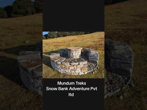
The Mundhum Short Trek is a moderate trekking route in eastern Nepal that combines Himalayan scenery with the living cultural heritage of the Kirat and Rai communities. The trail follows open ridges, forests, villages, and highland landscapes before reaching viewpoints around Silichung Peak.
The Mundhum Trail is located in eastern Nepal, passing through the hill districts of the eastern region and the traditional settlements of Rai and other Kirati communities.
The highest point mentioned for this itinerary is Silichung Peak at approximately 4,153 meters.
Yes. On clear days, the ridge around Silichung can offer views of Mount Everest, Lhotse, Makalu, and Kanchenjunga, although visibility depends heavily on weather and atmospheric conditions.
The trek is generally considered moderate. It does not involve technical climbing, but several days include 4–7 hours of walking over undulating ridges, steep ascents, and descents.
No technical trekking experience is required. However, reasonable fitness and the ability to walk for several hours on consecutive days are recommended.
Mundhum focuses more strongly on Kirat culture, rural villages, open ridge walking, and eastern Nepal's quieter landscapes. It is also considerably less crowded than the major Everest and Annapurna trekking routes.
Mundhum is the spiritual and cultural tradition of the Kirat people, containing oral traditions, beliefs, rituals, stories, and knowledge passed through generations. The trail takes its name from this living cultural tradition.
Salpa Pokhari is a sacred high-altitude lake located near Salpa Bhanjyang. It has religious significance for local communities and is an important cultural and scenic stop along the Mundhum route.
Accommodation is more basic than on established trekking routes. Depending on the section of the itinerary, trekkers may stay in simple teahouses, local lodges, or campsites.
Spring (March–May) and autumn (September–November) are generally the best seasons, offering better weather, clearer mountain views, and favorable trekking conditions.
Camping may be required on some sections where teahouse infrastructure is limited. The exact accommodation arrangement depends on the final route and current local facilities.
Permit requirements can vary according to the exact route and current regulations. Your trekking operator should arrange and confirm the required permits before departure.
Yes, fit first-time trekkers can undertake the route, provided they are comfortable with several consecutive days of walking and the altitude involved.
The itinerary currently presented on this package spans 11 days, including transportation to and from the trekking region. The exact duration can vary depending on the selected route and transportation arrangements.