
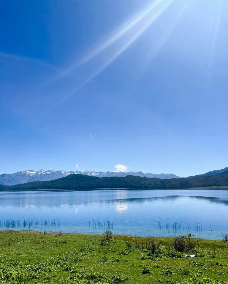
Rara 7 Days Tour
US $499

Most people who ask us about Manaslu have already done their homework on the Annapurna Circuit or Everest Base Camp, and they’re looking for something those trails can’t give them anymore: empty trails, teahouses that don’t have a queue, and a route that hasn’t been cut up by new roads. The Manaslu Circuit is that trek. It loops around Mt. Manaslu, the world’s eighth-highest mountain at 8,163 meters, through a restricted border region that Nepal only opened to trekkers in 1991 and still limits by permit. You’ll walk from subtropical river gorges at under 1,000 meters up to a 5,160-meter glacial pass, sleeping in stone teahouses the whole way and passing through villages where Tibetan Buddhist culture has barely changed in centuries.
This is Snow Bank Adventure’s 16-day version of the trek: Kathmandu to Kathmandu, with a rest day built in at Samagaon for acclimatization, and the option to keep walking onto the Annapurna Circuit afterward if 16 days isn’t enough for you.
Manaslu rewards a specific kind of traveler. You’ll get the most out of it if you are:
This trek probably isn’t for you if you want an easy introduction to trekking, need reliable WiFi and varied menus every night, prefer the busier, more developed infrastructure of routes like Annapurna Base Camp, or you’re not able to commit to at least two weeks with limited contact with the outside world. Because Nepal requires a minimum group of two trekkers plus a licensed guide on this route, it also isn’t a trek you can do solo or fully independently.
This comparison comes up constantly, and there’s no wrong answer — it depends on what you want from your trek. Neither route is “better.” Here’s how they actually differ:
| Manaslu Circuit | Annapurna Circuit | |
|---|---|---|
| Access | Restricted area — special permit, guide, and minimum group of two required | Open — no restricted permit needed |
| Crowds | Quiet, only a few thousand trekkers a year | Busier, especially in peak season |
| Roads | Almost entirely foot trail; roads only at the very start and end | Roads now reach much further into the route than they used to |
| Culture | Strong, concentrated Tibetan Buddhist influence in Nubri | More ethnically mixed along the route |
| High pass | Larkya La, around 5,160m | Thorong La, around 5,416m |
| Infrastructure | Developing — simpler teahouses, fewer choices | More established — more variety in food and lodging |
| Trekking style | Feels more remote and undisturbed | Feels more accessible and comfortable |
If you want fewer people on the trail, a stronger sense of remoteness, and a route that still feels the way trekking in Nepal used to feel, Manaslu is the better fit. If you want more comfort, more food options, and an easier logistics chain, Annapurna still delivers a spectacular trek with less commitment.
The trek starts with road travel from Kathmandu to Machha Khola. You’ll pass through Dhading and Gorkha districts, small farming towns where you’ll likely see people working rice paddies and kids walking home from school. Depending on road conditions, this leg is done partly by bus and partly by jeep, since the final stretch through Arughat and Soti Khola turns to rough, unpaved track. Expect a full day of travel — it’s bumpy, but it’s also your first real look at rural Nepal outside the capital.
Larkya La is the reason people choose this trek. At roughly 5,160 meters (some surveys put it slightly lower, around 5,106 meters — GPS readings vary by source, but either way it’s well above 5,000m), it’s the highest point of the circuit and the trek’s defining physical challenge.
You’ll cross it on one long day, starting in the dark, usually 3–5am, so you can get over the pass and down the other side before afternoon winds and cloud move in — a normal safety pattern at this altitude. From Larkya Phedi, the trail climbs steadily over rock and often snow or ice, with the final push to the pass being the steepest section. It’s not technical climbing — no ropes or crampons needed on a normal crossing — but the combination of thin air, cold, and a pre-dawn start makes it a genuinely hard day, typically 7–9 hours of walking.
This is also why the itinerary doesn’t rush you there. The days at Samagaon, Samdo, and Larkya Phedi exist specifically so your body has time to adjust to the altitude before you take it above 5,000 meters. Skipping or shortening this acclimatization is the single biggest cause of altitude sickness on this route, and it’s the reason a guided, well-paced itinerary matters here more than on lower treks.
At the top, if the weather holds, you get one of the best mountain panoramas in Nepal: Himlung Himal, Cheo Himal, Kang Guru, and Annapurna II line up across the valley, with prayer flags strung across the pass marking the highest point. It’s cold and the air is thin, so most groups don’t linger — a short rest, some photos, and then the long descent begins.
The way down is steep and can be hard on the knees, dropping through Larke Glacier’s edge to Bimthang, a small settlement with a stunning close-up view of Manaslu’s north face. It’s often the most physically demanding day of the whole trek, but also the one people remember most.
A lot of people search for “Manaslu Base Camp Trek” and don’t realize it’s the same route as the Manaslu Circuit — the base camp itself is a side trip, not a separate trek. It’s a day hike from Samagaon, following the Manaslu Base Camp trail up through moraine and glacial terrain to a viewpoint near the mountain’s south face, with close-up views of Manaslu’s icefall and surrounding peaks.
It’s a genuinely worthwhile detour if you have the time and energy, but it isn’t part of Snow Bank Adventure’s standard 16-day itinerary above, and it’s worth understanding why: there are no teahouses at base camp itself, so reaching it usually means camping overnight with a tent and cook crew, which most standard trekking groups don’t carry.
If you want to add it, let us know when booking — we can build it in as an extra day or two around your Samagaon rest day, but it does change your logistics and should be planned for in advance rather than decided on the trail.
The lower part of this trek looks and feels like rural Nepal generally — terraced rice and corn fields, Hindu and mixed communities, stone farmhouses. Somewhere around Namrung and Lho, that changes. You cross into Nubri, and the villages start to feel more like Tibet than Nepal.
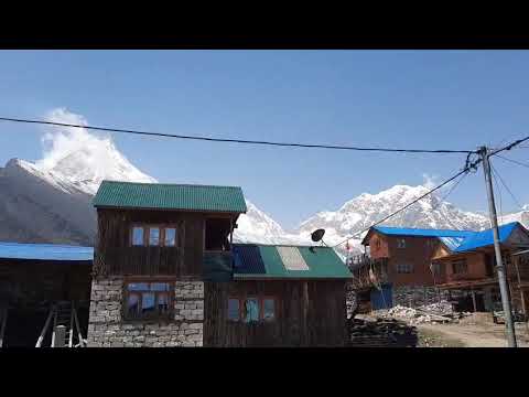
Samagaon is the heart of this. It’s a scattered village of flat-roofed stone houses under Manaslu’s north face, where families still raise yaks and grow potatoes at 3,530 meters. Prayer wheels line the paths between houses, and it’s common to see elderly villagers walking clockwise around the local gompa, spinning them as they go.
The rest day here is genuinely useful for acclimatization, but it’s also your best chance to slow down and look around: visit the monastery, watch yak herds move through the fields, or just sit in a teahouse and talk to people.
Samdo, higher up and closer to the Tibetan border, is smaller and starker — a windswept settlement that historically traded directly with Tibet before the border closed to that kind of trade. The Tibetan influence here is even more pronounced.
Throughout this section of the trek, you’ll pass mani walls (long stone walls carved with Buddhist prayers, always passed on the left), chortens, and strings of prayer flags fading in the wind. Some of the monasteries, like Pungyen Gompa above Samagaon, are centuries old and still active, with monks who will let visitors in respectfully. None of this is staged for tourists — it’s simply how people here live, which is exactly what makes it worth seeing.
Almost the entire trek runs through the Manaslu Conservation Area, a protected zone of roughly 1,663 square kilometers set up in 1998 to manage the region’s natural resources and support local communities through regulated tourism. Part of what you pay in permit fees goes directly toward that — trail maintenance, local schools, and conservation work.
What makes the conservation area worth mentioning beyond the paperwork is how much the landscape changes inside it. You start in warm, subtropical river gorges below 1,000 meters, thick with banana trees, bamboo, and waterfalls.
Within about a week of walking, that shifts to pine and rhododendron forest, then to open alpine meadows, and finally to high-altitude glacial terrain above the tree line — arctic in feel, even though you’re still in Nepal’s mid-latitudes. The area is also habitat for Himalayan tahr, blue sheep, and occasionally snow leopards, though sightings of the latter are rare. Few treks in Nepal pack this much ecological range into a single route.
Mountains: Manaslu (8,163m) dominates the upper trek, but you’ll also get views of Himalchuli, Ngadi Chuli, Ganesh Himal, and, from Larkya La, a wide sweep that includes Himlung Himal, Cheo Himal, Kang Guru, and Annapurna II.
Landscapes: River gorges along the Budhi Gandaki, suspension bridges, dense pine and rhododendron forest, glacial moraine, alpine meadows, and the frozen, wind-scoured terrain around the pass itself.
Culture: Terraced farmland and stone farmhouses in the lower valley, Tibetan Buddhist villages higher up, mani walls, chortens, prayer flags, and working monasteries like Pungyen Gompa.
Because this is a restricted border area, you can’t trek here independently — every group needs a licensed guide and the correct permits, all of which Snow Bank Adventure arranges as part of your booking. You’ll need:
A TIMS card is not required on this route — the Restricted Area Permit replaces it. Note that permit rules and fees do change from year to year, so we confirm exact current costs and requirements with you at the time of booking rather than quoting a fixed number here.
Day 1: Arrive in Kathmandu (1,300m)
Day 2: Explore Kathmandu, trek briefing and permit prep
Day 3: Kathmandu to Machha Khola (890m) — road journey
Day 4: Machha Khola to Jagat (1,340m) — walk
Day 5: Jagat to Deng (2,360m) — walk
Day 6: Deng to Namrung (2,660m) — walk
Day 7: Namrung to Lho (3,180m) — walk
Day 8: Lho to Samagaon (3,530m) — walk
Day 9: Rest and acclimatization day in Samagaon
Day 10: Samagaon to Samdo (3,860m) — walk
Day 11: Samdo to Larkya Phedi (4,460m) — walk
Day 12: Larkya Phedi over Larkya La (5,160m) to Bimthang (3,720m) — walk
Day 13: Bimthang to Gho (2,560m) — walk
Day 14: Gho to Dharapani (1,920m) — walk
Day 15: Dharapani to Kathmandu — road journey
Day 16: Departure from Kathmandu
The Manaslu Circuit is considered a challenging high-altitude trek. Long walking days, uneven terrain, significant elevation gain and the crossing of Larkya La make it more demanding than many lower-altitude trekking routes.
Larkya La is listed at approximately 5,106m for this itinerary and represents the highest point of the Manaslu Circuit.
This Snow Bank Adventure itinerary takes 16 days, including arrival, trekking, acclimatization, transportation and departure.
The two treks have different challenges. Manaslu generally feels more remote and has simpler infrastructure, while its restricted-area requirements and Larkya La crossing make it a demanding experience. Annapurna has more developed infrastructure along much of its route.
It is better suited to trekkers with previous multi-day trekking experience and good physical fitness. Beginners should be prepared for long walking days and significant altitude.
Yes. Because the route passes through a restricted area, trekkers must follow the applicable guide and permit requirements for the region.
The trek requires the relevant Manaslu Restricted Area Permit, Manaslu Conservation Area Permit and Annapurna Conservation Area Permit, along with any applicable local fees. Current requirements and fees should be confirmed before departure.
Yes, Manaslu Base Camp can be visited as a side trip from Samagaon, but it is not included as a standard day in the 16-day itinerary you provided. It should therefore be arranged in advance.
Spring and autumn are generally the preferred seasons, particularly March–May and September–November, because of more favorable trekking conditions and mountain visibility.
No. A normal Larkya La crossing is a high-altitude trekking challenge rather than technical climbing. Snow and ice conditions can vary by season.
Most trekking days involve roughly 6–9 hours of walking, although actual times vary depending on the route, altitude, weather and group pace.
Accommodation is generally in teahouses and local lodges, with simpler facilities than those found on Nepal's more developed trekking routes.
